Utility Locates and Locating During Mega Project Planning
Working smarter with SUE data to provide work plans and a common utility base map during projects
Over the past 10 years, Canada has had a trend of trying to reduce its transit and infrastructure gaps by initiating large scale mega projects. These projects include the Eglinton Crosstown Light Rail Transit (LRT) and Finch West LRT in Ontario, the Edmonton Valley Line LRT and Edmonton Ring Road (Anthony Henday) in Alberta and the Regina Ring Road.
No matter where you are in the Canada, there seems to be a mega project in execution or planning. The motto that the Government of Canada released with the Canada Infrastructure Bank is, “Building stronger communities and improving quality of life for all Canadians.”
As the federal government releases waves of infrastructure stimulus funding to support necessary projects to maintain the high quality of life we strive for in our communities – this is a great time to be involved in the infrastructure community.
With the realization that utility conflicts cost time and money to these large and complex projects, subsurface utility engineering (SUE) is often included as part of the design process. Ontario has been a leader in this area and has started to include SUE into the technical advisory phase of most large projects. This has trickled up from the use of SUE on large municipal projects to larger multiple government partnership-funded and joint jurisdiction projects like capital transit and highway projects.
A large item that has been noticeably missing is the use of the SUE data for all engineering disciplines – not only for the deep or shallow structure design – but rather having it included and completed prior to the geotechnical program as well.
Understanding all infrastructure impacts is important for the geotechnical drilling and generating the geotechnical baseline report (GBR). The selection of boreholes, based on a SUE engineering drawing, would allow the geotechnical engineering team to better understand the pedigree of the existing information and provide a more accurate selection process. This would save a great deal of time and coordination efforts in the execution of the overall geotechnical program.
RELATED: Tech Forum: How the Future of Underground Mapping Can be Found in the Cloud
The more information that is used during planning would minimize the requirement to move holes and have a greater and more accurate understanding of the ground conditions. The Geotech would know where there is native fill vs. trenches and other utility, or even other non-utility related items often found during SUE investigations. All of these have an impact on drilling.
All of the engineering disciples would have access to the data to be shared among the project team vs. the typical silos of infrastructure disciplines and other related planning and engineering tasks.
A few of the current, larger LRT projects in Ontario have started to act in this manner, having the SUE consultant as an active partner in planning and executing the geotechnical program backed by SUE data as the initial guide. The process used is a great example of where all the pieces fit and, if done right, it provides a better, more efficient project.
RELATED: Innovations in Mapping Underground Infrastructure on Light Rail Transit Projects
The initial concept of doing a comprehensive SUE investigation does not change. Understanding utility impacts is still paramount. Rather, it is about using the geotech program not just as a construction activity, but a fluid process and using SUE for the initial decision-making process. Leaving the request for One Call locates on public facilities and private facility locates for its true function, damage prevention, health and safety.

A CCTV truck equipped with a lateral launcher (above) allows the locator to find and properly mark the lateral on the sidewalk (right).
This is in line with the One Call Act in Ontario (Bill) 8 that mandates that locates be provided by all owners of infrastructure on public domain and the regulations that private facilities are accounted for as well during excavation. This extra step, using information that would already be paid and provided during the engineering and planning by way of a SUE investigation. The effort to extend this to the geotech program would far outweigh the cost of the additional effort to coordinate with the SUE provider.
Since the One call system has become law, the efficient use of one call locates becomes paramount as the utilities have very tight budgets to provide timely, efficient and safe marking of facilities for construction, and not engineering planning. The use of One Call field locates for engineering planning actually causes a burden on the system, backlogging legitimate construction locate requests.
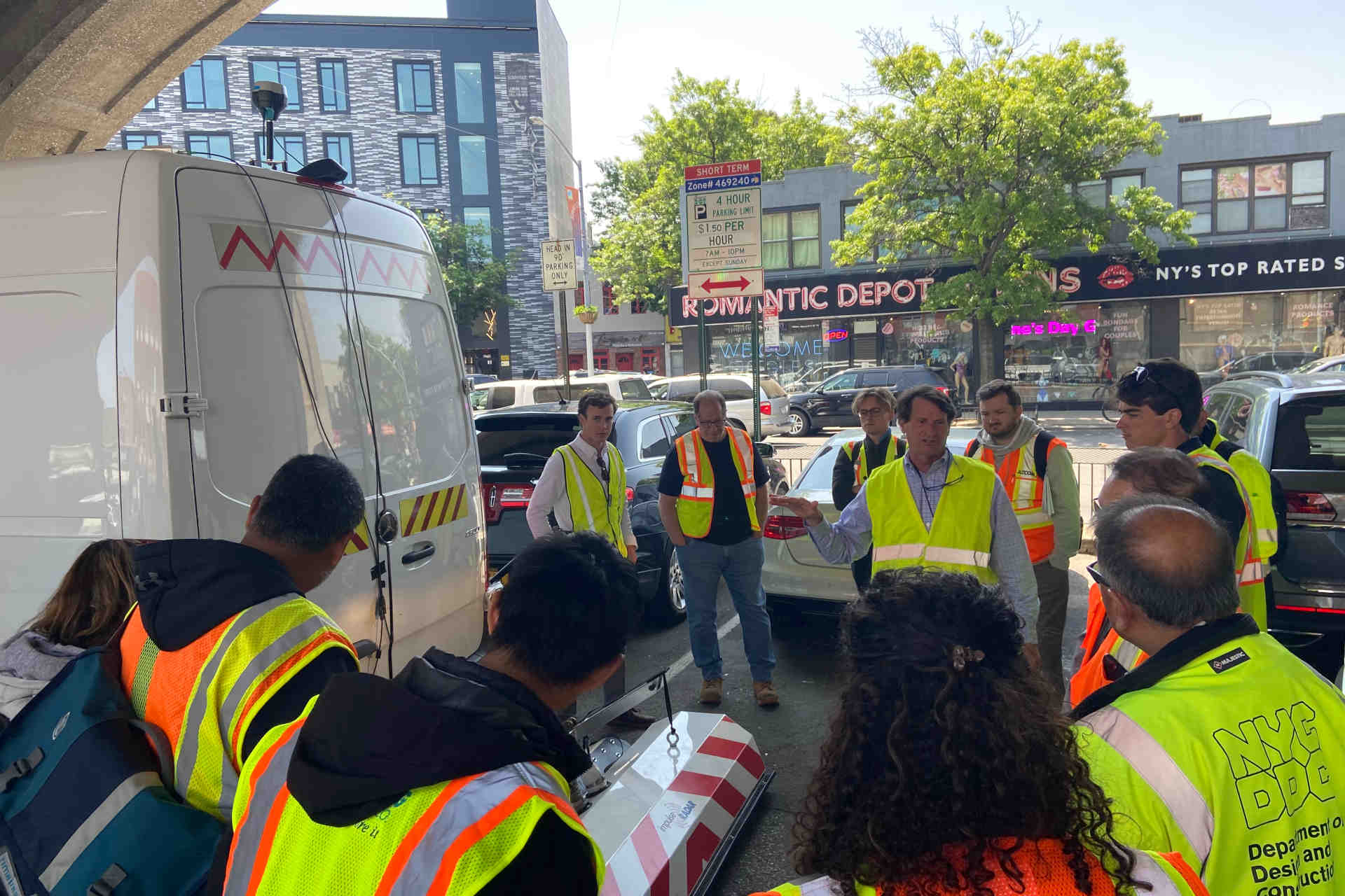
The project discussed is a large LRT in progress in the Greater Toronto Area (GTA) is a prime example of lessons learned, and following the progression of using SUE data for planning to guide the work and the execution of the geotech program.
The SUE and utility coordination phases conducted as a part of the technical advisory team for the inception and early works of the project were done following the Transportation Association of Canada (TAC) Utility Coordination and Relocation Guidelines.
The initial full SUE investigation that was completed using a wide variety of geophysical tools and engineering expertise looked for utility conflicts and feasibility of concept and identification of all utilities that would need to be relocated, replaced, removed or rehabilitated to accommodate the new LRT.

The pink markings indicate the buried utilities highlighting just how congested the underground space has become.
The project used a combination of MCGPR, lidar survey, standard electromagnetic (EM) locate sets, CCTV (with specialized adapted equipment for utility designation¹) as a part of the CCTV condition assessment and sewer lateral location.
RELATED: The Why, When and Where of SUE vs. One-Call
By having this information upfront and coordinating with the geotech program during the SUE investigation, the process did mitigate the amount of construction locate requests, and a drilling process been established, and hopefully lessons learned from the project will be taken away and used on other projects in the future. A SUE investigation will never absolve you from calling one call for public locates prior to excavation but it will allow you to focus your calls and maximize your field efforts where needed.
This project is a great example of using many technologies in combination with engineering scrutiny of existing utilities and providing a comprehensive risk mitigation tool for designers and planners of such a large-scale project.
1-Utility Designation is the term used in engineering when you are marking utilities in the field for engineering purposes. Locating in the engineering vernacular means verifying though test holes, the location of the target utility. For the purposes of this article locating refers to the practice of construction one call locates.
Ophir Wainer, B.Sc., senior principal at T2 Utility Engineers. Ser Da Silva, manager of CCTV services at T2 Utility Engineers.