How Location Data Minimizes Excavation Damage
Underground excavation in construction can be risky. Generating and sharing accurate location data can reduce these risks.
For a densely populated country such as The Netherlands, managing a foundational asset has become complex. Yet the country realizes the importance of mobility to stay competitive economically, and has invested heavily in new roads, public transport and railways. Because of its small size, though, there has been limited space to fulfill the expansions.
The same space constraints apply to underground developments. Public utility authorities and telecommunication companies have had to consistently find ways to maintain a dense and complex web of pipes and fiber optic cables, while also upgrading and adding new connections to the network. Maintaining this balance requires not only careful design and planning, it also demands a common operational picture among the various stakeholders to ensure excavation damage can be avoided when a project involves underground construction and drilling work.
The Dutch company, Van De Beek Bedrijven, specializes in the layout, design and drilling of underground cables and pipes. Although it initially targeted the telecommunication sector, the company currently serves utilities and large contracting firms. It has a staff of 40 people, consisting of a field crew and an office crew that manages the firm’s design and consulting practices.
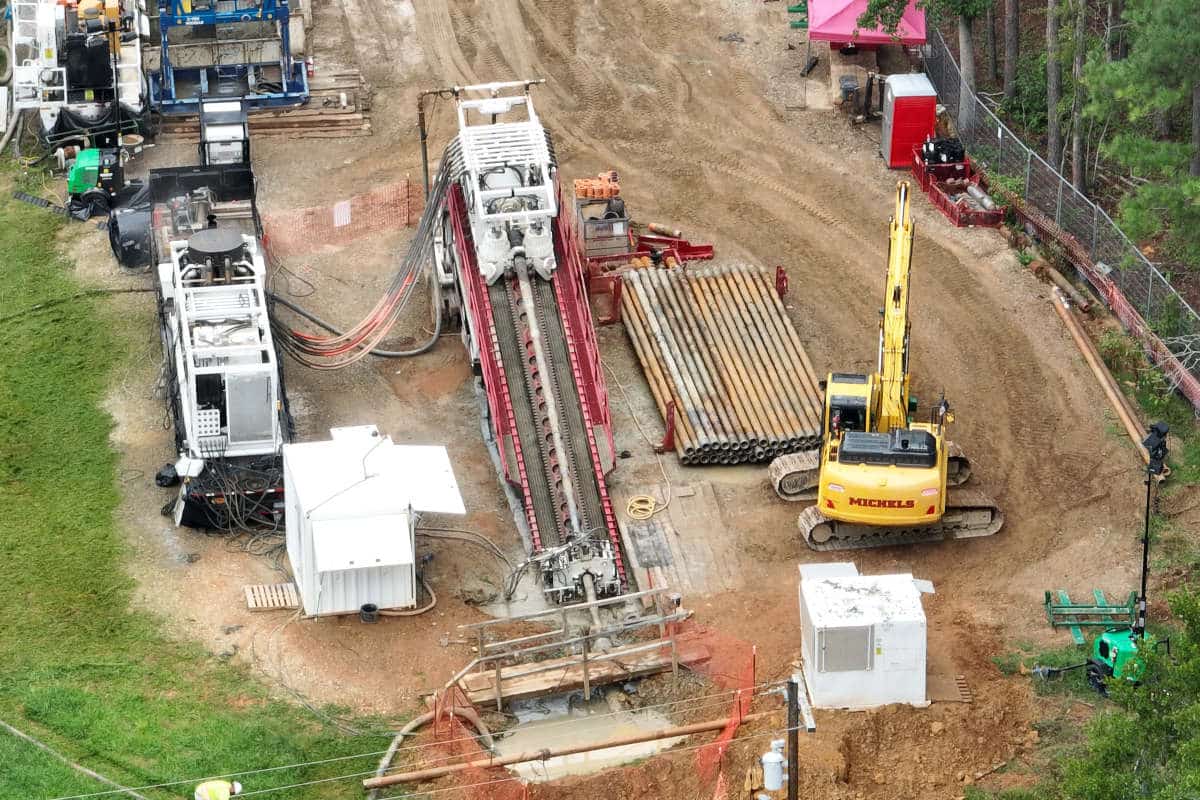
What’s beneficial for underground excavation projects is Van De Beek Bedrijven’s expertise in horizontal directional drilling (HDD), a method of installing underground pipelines or cables through trenchless methods. Using a surface-launched drilling rig, the machine lays pipe or cable in a shallow arc along a prescribed bore path, minimizing the impact on the surrounding area. This method is used often at traffic intersections, where stopping traffic with an open trench is not an option, or in places such as waterways where there’s no other recourse.
Since 2016, the company has been using a Trimble R2 GNSS receiver combined with Trimble TerraFlex software to measure and guide the drilling to ensure the planned alignment is followed. The R2 and TerraFlex measure the ground-level position of the drilling head. Operational data from the drilling head and helix angle are communicated to the drillmaster via a cabled or walkover system, allowing the drillmaster to both control the direction of the drilling and monitor the underground excavation from the surface.
The R2 can connect with many mobile devices, including smartphones and tablets, all of which can run TerraFlex. This flexibility has enabled the company to increase their workflow efficiency. For example, in the past, a design drawing was made in the office and staked out in the field with pegs and a GNSS system. Now, field crews can use a tablet with the R2-TerraFlex combination to show the drilling lines instantly on a map, eliminating the previously labor-intensive process of dispatching a field crew to manually stakeout a particular line.
Arie van de Beek, Jr., co-owner of Van De Beek Bedrijven, explained the current workflow: “The drilling line from the design drawing made in the office is converted to a KML file and loaded into Trimble TerraFlex, which crews can immediately view online in the field.”
Once an asset has been staked out, drilling can begin. For deep underground installations, the crew receives information on the drill head location from the drilling machine while the R2 captures x-y positions on the ground, for defining the as-built location. The drilling information is logged every two meters and sent to a crew member using a walk-over system to follow the drilling path on the ground. The information is input into TerraFlex. Crewmembers can compare the field information with design data to immediately identify any deviations from the original drilling design.
For shallow drilling projects, the drill head transmits its depth location to the walk-over system, allowing the assistant drillmaster to record the depth data with his control box. In the case of a deep drilling process, or when there’s a lot of distortion caused by aboveground objects such as a railway, depth-location signals are sent with the aid of a cabled system through the drill rod. The depth values are documented digitally on a tablet and are populated onto a review document that shows the as-built track and depth of the newly-installed asset.
When drilling is complete, field crews use TerraFlex software to collect the horizontal and vertical as-built data of the drilling’s ground-level position. During the drilling process, the drilling line is marked based on data from the walk-over system. Using the walk-over data as reference, these markings are subsequently measured with the R2 at an accuracy of 4 cm. This accuracy is well within the requirements for the infrastructure market and is attained by using a correction signal from a Dutch commercial company with a network of GNSS reference stations. The positioning information is sent back to the office automatically through the Trimble TerraFlex web-based application and read into AutoCAD.

Once the HDD project is complete, the collected data is compiled on a digital review document, which details the precise location of the pipe or cable installed.
Bringing the field operations to the office in real-time allows the company to design, plan and manage drilling projects from their own desktops.
“The whole process of design-implementation-realization happens in the office,” said Arie. “The field crew can see this information in the field immediately and see the planned alignment for the drilling. There’s no need to do a manual stake-out process. This saves us time and, in the end, money.”
The data that is collected is much more reliable. In the past, the locations of cables and pipes were based on their relative position to aboveground objects. With the new system, coordinates of cables and pipes are measured with GNSS. Transitioning to real-time precision has not only allowed the company to shelve its former relative and unreliable positioning methods, it’s given them the tools to digitize the entire design, stakeout and measuring process and eliminate analog design methods.
“This also means there’s no more conversion necessary from paper designs to a national coordinate system, as data capture happens now directly in the field,” said Arie.
Besides ensuring more accurate data, TerraFlex enables crews to gather more detailed data. When a position is collected, attribute data can be added, such as the time of day, project number or the amount of cables surrounding that point. “This means we’re registering more than just a position,” Arie said. “By unlocking such data through a map, we’re using a GIS type interface.”
At one time field teams recorded data on pre-prepared, static paper forms. Now, customizable, digital templates provide the flexibility to create data-specific, fillable forms in minutes. Based on the success of those field templates, the company is investigating the possibility of integrating the TerraFlex-based information into its invoicing system. Having the accurate, up-to-date field data would enable them to readily adjust drilling project costs. For example, if it’s clear that the length of a drilling differs from the initial length, they can modify the price accordingly.
Once the HDD project is complete, the collected data is compiled on a digital review document, which details the precise location of the pipe or cable installed. This document is critical because it serves as input for the country’s KLIC database, a national online database managed by the Dutch Cadaster that contains all past review documents of the Dutch underground infrastructure. Anyone conducting mechanical excavation work is required to consult the system, both to prevent any possible future excavation damage, and to be able to locate an existing cable or pipe quickly.
Dutch Cadaster professionals consult the KLIC for proposed underground work, so it is crucial that contributing agencies provide timely, precise locations of their assets. With the new GNSS solution, Van de Beek Bedrijven can ensure that their aboveground operations will deliver safe, efficient and effective underground excavations.
Eric van Rees is a writer specializing in the geomatics, civil engineering and construction industries.