What Is XYZ Mapping?
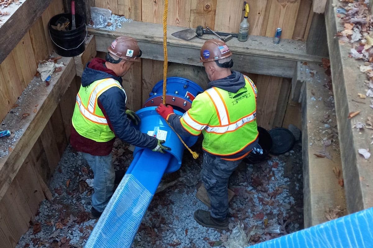
Mapping pig used to document two, 8-in. conduits in Washington, D.C.
Every day, contractors around the world install new subsurface pipelines without knowing what may already lie in their path. When space is at a premium, like in major cities, the phrase “every inch counts,” applies in a number of ways. A single cross bore can cost tens of millions of dollars to fix, not to mention the risk to life, serious injury, and property damage; therefore, accurate locational data for underground pipelines is paramount.
As subsurface infrastructure continues to increase around the world, keeping accurate locational data becomes essential. Obtaining that data is not always easy, with many obstacles to overcome, such as limited access points, time constraints, bends, and pipe material. The case was no different in Washington, D.C., where, in 2023, American Pipeline Solutions (APS) was tasked with the XYZ mapping of two 8-in. conduit pipelines.

What Are the Benefits of XYZ Mapping?
The concept of XYZ mapping refers to mapping pipelines in three dimensions (X, Y, and Z axes). Each axis represents a different geospatial location in a three-dimensional space. The X-axis represents the horizontal direction, the Y-axis represents the vertical direction, with positive values, and the Z-axis represents depth in the three-dimensional space. Using various types of technology, it is possible to establish accurate locational data for pipelines in three-dimensional (3D) space.
Over time, advancements in sensor technology, robotics, gyroscopes and data processing have further enhanced the accuracy and capabilities of XYZ pipe mapping, making it an essential tool in the maintenance and integrity management of pipelines in various industries, including oil and gas, water distribution, and chemical processing.
XYZ mapping in pipeline inspection and maintenance offers several benefits. One key advantage is its ability to provide a highly accurate location of a pipeline in a 3D plot. By creating detailed 3D maps of the location, asset owners can build around, maintain and even replace the lines with ease. This proactive approach not only improves safety by reducing the chances of crossboring but also helps operators comply with regulatory requirements.

The D.C. Project
APS, a national pipeline pigging company, was brought in by a client to XYZ-map two complex underground pipelines in the center of Washington, D.C., just steps away from the Capitol Building. The pipes were two 8-in. PVC conduit lines, each spanning 3,300 ft and located roughly 40 ft below the surface. Additionally, the pipe was only available for seven hours, as one of the two access points was on a major street, which needed to be clear before rush hour.
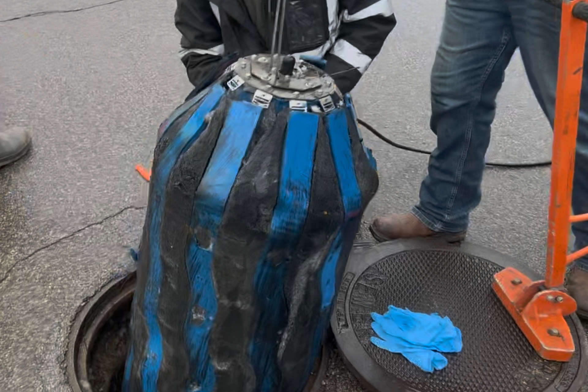
If all of that wasn’t enough, the pipeline itself was complex. Multiple sweeping 90-degree bends and numerous ascents and descents made the use of a pull-through gyroscope impossible. After careful planning and examining all options, APS opted to use a specialized pig, which was capable of completing multiple runs and fitted with an advanced inertial mapping unit. This mapping unit is roughly four times more powerful than the industry standard, which allows the pig to achieve levels of mapping accuracy to within 6 in. in some cases, which is unheard of in the industry. The pig is free-swimming and, therefore, can be sent through the pipe at a rapid rate while navigating the complex number of bends. This, in turn, reduces the time required to collect the data and the chances of damaging the pipe.

The Results
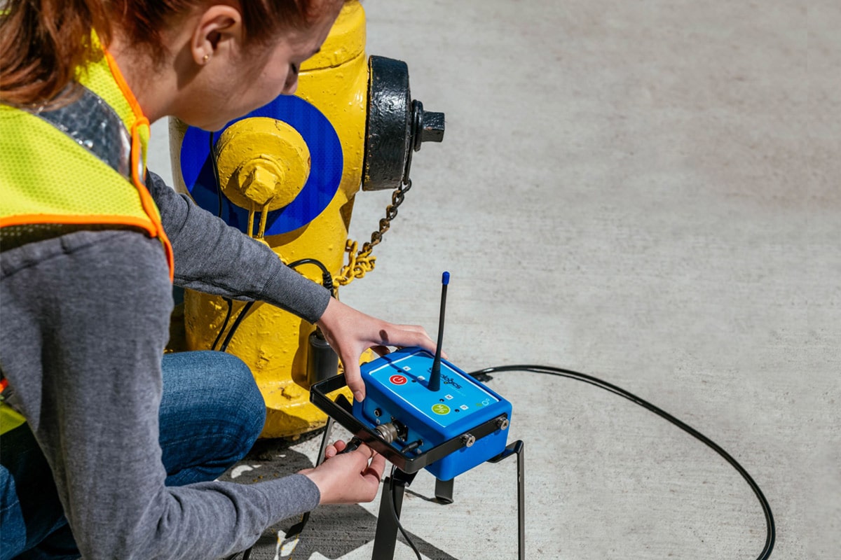
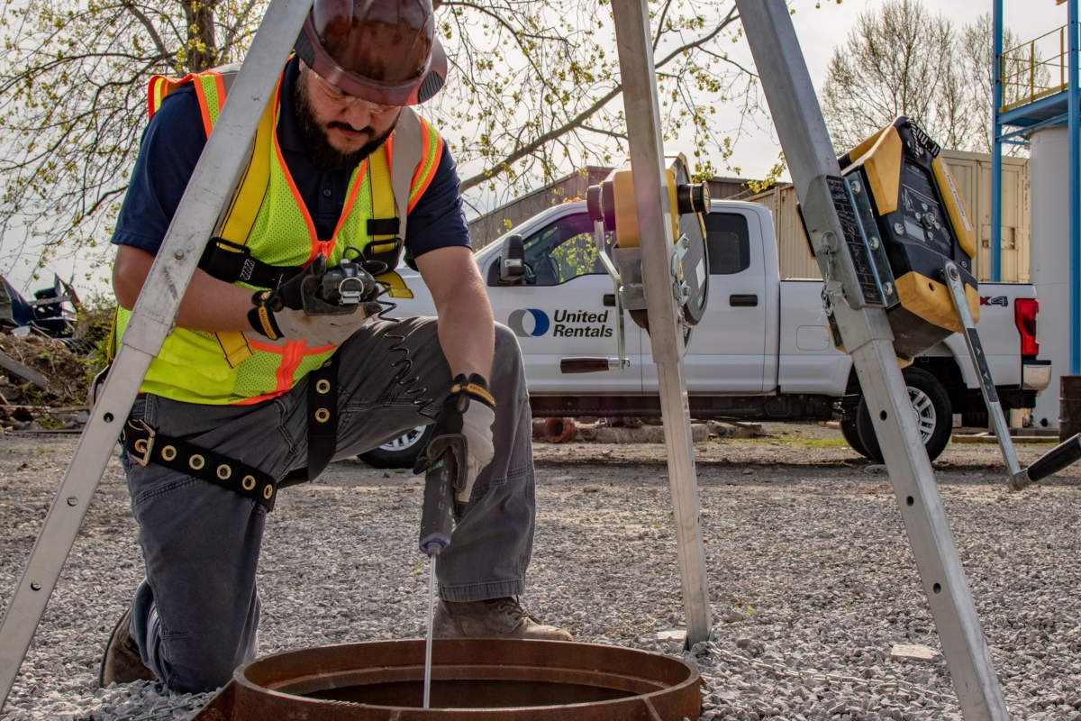
The free-swimming mapping pig was hand-inserted into each pipeline, followed by an inflatable plug to seal the pipe during transit. The pig was then launched and subsequently pushed through the conduit utilizing water from a local fire hydrant and a pump. The water on the retrieving end was removed via a pump and disposed of in the local storm sewer.
Each run took approximately 34 minutes, followed by an additional 25 minutes to verify the data quality was acceptable. During that time, the mapping pig was returned to the starting point and prepped for an additional run. Once the data quality was confirmed on the second run, APS removed their equipment and demobilized within 45 minutes. This allowed the access points to be sealed with ample time to spare and highlights the small footprint that is required to utilize this tool in the field. Not only is the expediency at which the tool can be deployed and recovered important for restricted windows, but it also saves money. Tethered tools require multiple runs and are restricted to the speed at which they can be pulled through. This all affects the bottom line not just for the service company but for everyone involved in the project.

As with many other mapping tools out there, one requirement is survey data for both the entry and exit points of the pipe. Ideally, an accurate midpoint is provided, which the mapping analysts use to calibrate the data retrieved from each pig run. The more known points along the pipeline to compare with, the more accurate the overall map will be.
The main data findings of the underground XYZ mapping provided a comprehensive XYZ map of the pipeline with sub-meter accuracy. The data was interpreted and analyzed to ensure its accuracy and applicability, and there were not any unexpected discoveries reported during the mapping process. The data provided was crucial to the client and answered many key questions, which allowed them to continue to the next phase of the project.
Blake Murphey is vice president at American Pipeline Solutions.