Studying What’s Below: Team Effort Exceeds Client’s Surveying Expectations
Have you ever passed a petrochemical facility and stared at all the intricate piping racks feeding various regions of the plant? For all of what you can see above ground, there are equally important, complex piping networks below ground.
While engaged in conversation with a potential client about all the unreliable data received over the years from various survey companies, Global Raymac Surveys Inc. confidently stated, ‘we’ could solve their problem.
The potential client had some skepticism, and ‘How’ was asked as, “you’re just another survey company.” The immediate answer was “Global Raymac knows what we can do and who to bring along to support what we cannot do.” The conversation continued and it culminated in Global Raymac being asked to map and model above/below ground assets.

Knowing the limits and capabilities of what a geomatics company can execute, Global Raymac engaged T2 Utility Engineers (T2UE) for a partnership to deliver the project. Why? Underground designation requires skills, knowledge and advanced geophysical tools in order to properly identify buried infrastructure.
With this strategic partnership, both teams collaborated to deliver what was promised by leveraging the expertise within each company. T2UE can locate and designate the underground infrastructure and Global Raymac can properly collect and map the results in a geospatially correct deliverable. The project consisted of two phases, pending the review of Phase I by the client. With the teams in place, and the scope defined, it was go-time.
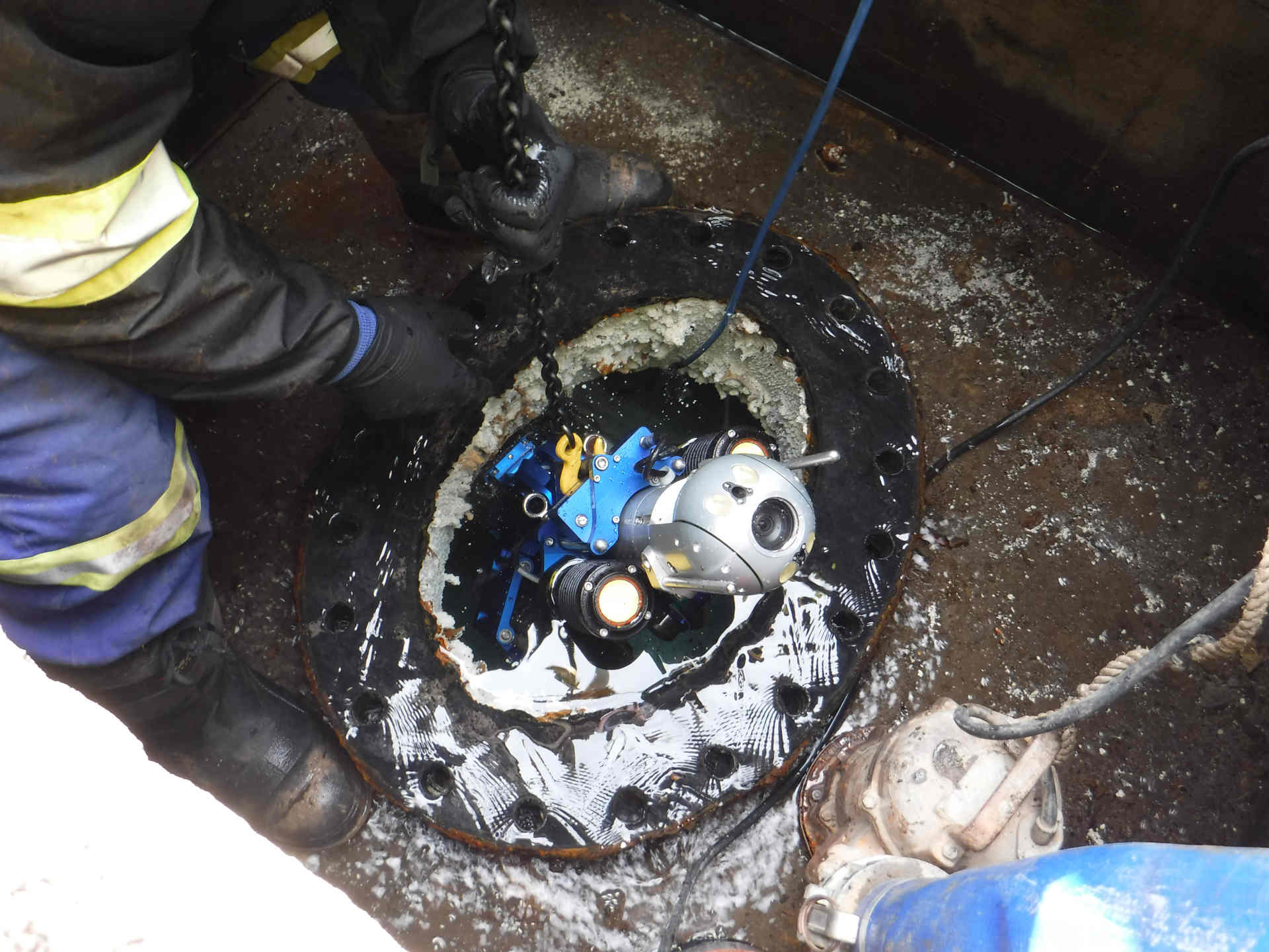
Hitting the ground armed with an arsenal of advanced tools, the investigation and collection began for Phase 1 was under way. The Global Raymac and T2UE teams deployed high-definition laser scanners, unmanned aerial vehicles (UAVs), global navigation satellite system (GNSS) and single/multi-frequency electromagnetic locating equipment.

Geodetic control was established on site and related to the ‘site-specific’ coordinate system. The designation team was inundated with locating the cluster of gathering/supply lines buried on the site. With proper practices and procedures being used, the investigation was soon completed. As all the buried facilities were detected and marked by T2UE, Global Raymac was alongside to collect the geodetic position to feed into the final deliverable.
The collected digital field data was then processed, compiled and drafted into a 2D plan, overlaid on a high-resolution orthographic image collected from the UAV flights. Most importantly, the information collected was geodetically correct resulting in a retraceable and repeatable deliverable. Furthermore, Global Raymac and T2UE were able to compile all the information on the drawings as per ASCE 38-02 Standards from proper practices and procedures used in the field.

With confidence built in the client after delivery of Phase I, written notice was received to proceed with the execution of Phase II.
At this juncture, a multi-channel ground penetrating radar (MCGPR) unit was deployed. With the integration of GNSS on the MCGPR unit, scans were completed of the site. The integration of the geodetic position with the results of the GPR allow for a spatially correct model to be developed for the below ground infrastructure.
Both Phases combined, created a 3D geospatially correct model and each utility had the associated quality level to allow for judgement and confidence in the deliverable along with a signed and sealed subsurface utility engineering (SUE) report. These two SUE items, along with the correlated survey data, generated the deliverable to be viewed by the facility operations team on tablets or computers while in the field, providing a thorough understanding of what their facility contained and the certainty behind each line designated.
This data was also fed into the engineering team software to model for upcoming site improvements knowing, with confidence, there would be a reduced chance of conflict in the design. Thus, saving time and money by accelerating the execution schedule along with no rework or ‘surprises’ in the field during construction. Piece of mind was promised, achieved and delivered.
Steaphan MacAulay, vice president Transportation & Infrastructure at Global Raymac Surveys Inc.