NASSCO Report – The Use of Unmanned Aerial Vehicles in Below-Ground Structures and Pipe
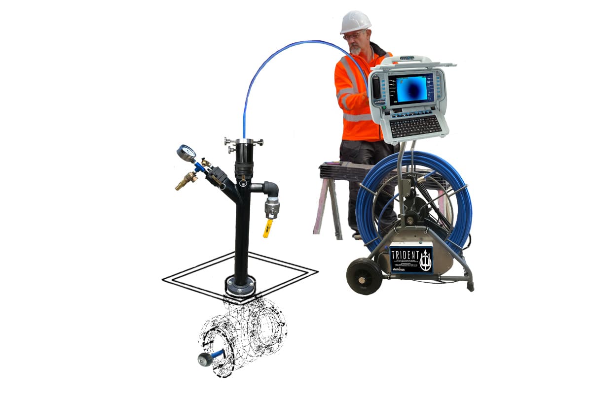
The choice of inspection technologies for below-ground assets is increasing within the industry. With the advent of greater resolution, tracked, large wheeled or floated platforms with the added benefits of supplemental technologies such as time of flight laser and sonar are giving the certified NASSCO PACP professional better clarity of asset condition.
Yet even with the best intentions and project development, there are still critical large diameter assets that may never attain a full inspection. Reasons include construction features such as weirs, within segment stepped and reduced diameters; flow control monitoring equipment; debris or obstructions; or even a major defect that could inhibit further inspection. A recent outfall inspection project enforced an “inspect to clean” ethos to mitigate contaminants to watercourse from any cleaning activities, where rovers would have to navigate on or around settled, built-up debris levels and timber obstructions that made full inspection completion very difficult.
RELATED: NASSCO Gearing up for CIPP Emission Study: Phase 3
In cases like these, taking to the air can be the solution. Many unmanned aerial vehicles (UAV) — or drones, to you and I — are small enough to access such assets and feature more than adequate lighting capability, carbon fiber collision resilient frames for protection, and have the capability of accessing below-ground GPS-denied environments. These units afford high definition and super high definition, 1080P to 4k pixel ranges, respectively, that have applied distance parameters to ensure low spatial resolution (2 to 3 line pairs per millimeter (LP/mm) or better) to inhibit motion blur to object distances of 300 – 400mm (12 to 16 in.) at NASSCO’s governed 9 m (30 ft) / minute speed. This means that, if you pause the video at any time to look at a close-up image of a crack or fracture while in motion, you will continue to see a crisp, clear (i.e., photograph quality) image.
For any prospective operator using UAVs there are rules, regulations, registrations and permits that must be adhered to depending on your location. In the United States, anyone flying UAVs for work outdoors must currently pass a knowledge test and obtain a Remote Pilot Certificate from the Federal Aviation Administration, as well as following a list of requirements called the Part 107 rules. Canada has similar rules to the United States, with Transport Canada currently requiring pilots to obtain a drone pilot certificate to fly for work outdoors. It is important to complete regulatory and airspace research when planning to use a UAV for inspections. Varying protocols and procedures may be in place within any State, Province, City or even an area of a City where “No fly” zones may exist, prohibiting or restricting flight near sensitive infrastructure and airports. Therefore, extensive project development and the involvement of professional UAV operators will be necessary to ensure UAV inspections can be carried out at your site location.
To date, several cities and municipalities have used UAV’s successfully as a means to reactively mobilize a remotely controlled camera to quickly identify problems within the sewer pipe. However, for planned inspection programs, the client still expects to see a NASSCO PACP-coded report as a deliverable, identifying defects and features inside the pipe at calibrated distances relative from the pipe to access chamber interface. This is all important, as trenchless rehabilitation technologies would be applied based on the distance thresholds given within the report, where rehabilitation cost estimates would be determined accordingly. To date, using UAVs for reporting purposes has been difficult where the PACP technician would quantify the number of pipe joints to discern the estimated distances for point or continuous defects, or having to use further post-processing technologies such as photogrammetry to achieve more accurate results. Another challenge may be the availability of NASSCO-certified software for documenting the inspection versus a “compliant” report.
RELATED: NASSCO Report – Manhole Committee: ‘I Have Seen It All.’
The miniaturization of visual odometry equipment providing sparse point cloud is now resolving the issue of identifying the location of defects discovered during data collection. Drone technology now has the means to attain point cloud data of the pipe to allow the UAV to know where it is spatially and more importantly, where the defect is within the pipe.
As these technologies become more prevalent within the industry, NASSCO PACP-certified Engineers must consider the inclusion of UAV technologies during their project development stage. During this phase, the Engineer must further develop a robust, safe work plan, consideration and inclusion of force ventilation to create an intrinsic environment, discern UAV safe access and egress, the mobilization of radio frequency extenders, know current UAV distance limitations based on pipe material and configuration and the ramifications of UAV retrieval or loss. Having this knowledge will help produce a robust and all-encompassing set of inspection specifications to include both conventional CCTV inspection equipment and UAVs.