GIS Information Is Only a Mobile Device Away at the Project Site

It is only a matter of time that several technologies eventually meet at a crossroad whereby integration of these technologies collectively evolve as a powerful tool.
For the horizontal directional drilling (HDD) contractor and the construction industry as a whole, accurate and accessible subsurface information is one of the most important components to a successful project not rife with delays and safety hazards for all stakeholders. Several technologies met at this crossroad over the last decade and are now providing information heretofore that was compartmentalized on an office server miles away from the project site. Subsurface utility data was relegated — as was all relevant site data — to printed drawings.
Not long ago, precision GPS technology seemed out of reach for the average user and was relegated to licensed survey professionals for traditional stake out and boundary type survey activity. These functions remain important and necessary staples for the professional surveyor but the technology is now integrated into a myriad of platforms integral to building a digital twin of our world including the subsurface.
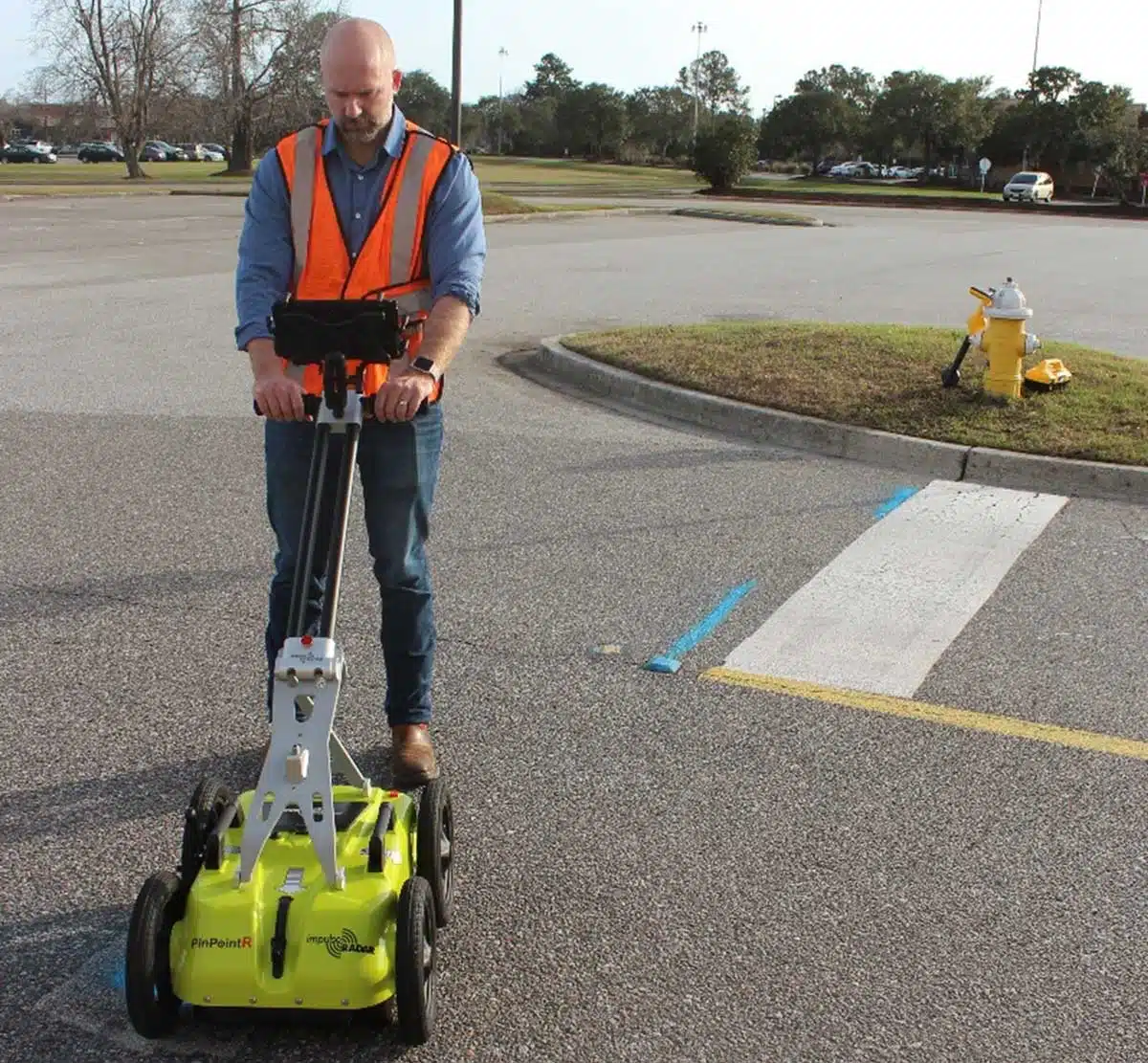
Cost and complexity over time, both substantially reduced, facilitated integration of GPS in a host of devices. Important to the construction industry is the seamless integration of RTK GPS into GPR and EM locator technology. This also includes drones for aerial photogrammetry and LiDAR imagery, as well as land based hand-held cameras. The capacity to map the world has flourished and is changing how we look at the world above and below ground. The concept of the digital twin is now universal for both spheres. RTK GPS systems with precision of less than a couple of centimeters can be purchased from several manufacturers for less than $5,000.
Not only is cost a factor for more integration but the ease of use of these systems and workflows are clearly superior than systems just a few years ago. Several of the RTK GPS systems are operated from a mobile device either Android or iOS as an app and developers adopted the app culture approach of clever intuitive workflows on these devices. The beauty of the app is it can be updated regularly online with new features and any bug fixes that are endemic in software.
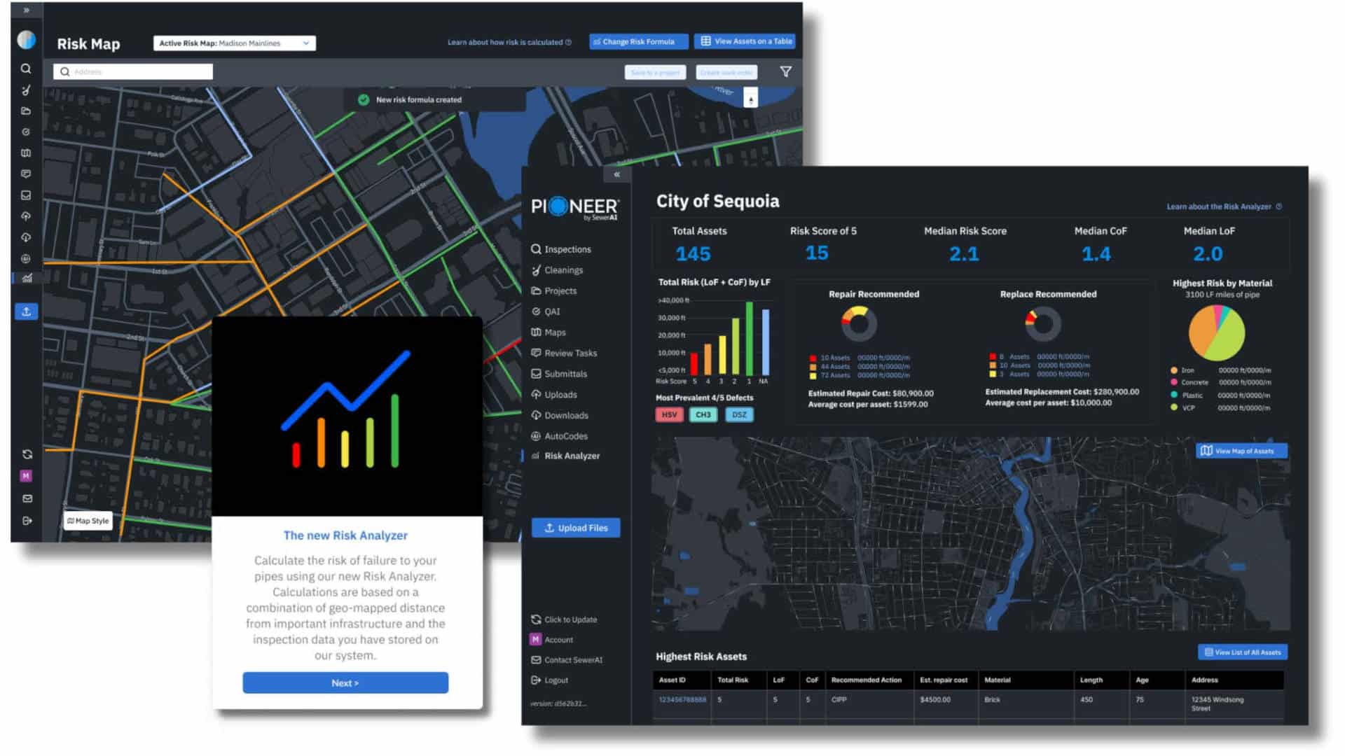
RTK GPS system integration with GPR systems today is essentially standard. Electromagnetic locators such as the Vivax-Metrotech vLoc3-Pro also integrate RTK but is not as prevalent in that industry as with GPR. This is an important step to getting precision utility information from the subsurface into a platform that hosts other precision data. A utility locate professional can now in real time upload their mark outs from both GPR and EM locators directly to the next crossroad-cloud based GIS type mapping platforms. This also includes geotagging photos taken with the mobile device for additional valuable information of the work area.
Most users of the GPR generated utility location information export these marks as KMZ, CSV, or other format into Google Earth or GIS platform to an office server. These data are then included into a base drawing or field sketch at a single repository at a unique office location. Access to these data is relegated to a printed drawing or at best a PDF or some other screen capture. Getting this information in the hands of field personnel was cumbersome and certainly not accessible on demand. Mobile software apps such as PointMan from Prostar Geo take advantage of Amazon Web Services (AWS) cloud services. The PointMan app is fluid and can automatically accommodate not only GPR from the PinPointR and EM data but a host of other data that is relevant to the construction or HDD boring crew on site.
Data can also be visualized on a mobile device by any field persons utilizing the app. Circling back to RTK GPS it is now feasible to connect a low cost RTK GPS system directly to the same smart phone. This means you can walk the site with a moving map of the digital representation of the underground.
Relevant data details regarding each underground facility is accessible by simply selecting the utility on the screen. It is important to note that the quality of the depiction of the underground facilities is only as good as the quality of the original source and potential later manipulation of the data. Important information that must be logged is a chain of custody of the data e.g., who collected, how the data was collected (e.g., GPR, EM, records search) precision of the GPS or other positioning system at the time of data collection to name a few. Most states also require an engineer or professional land surveyor in Responsible Charge to oversee data collection for scaled precision drawings. In addition, following the SUE standard for quality levels is important.
The intersection of different technologies and their eventual integration can be unpredictable at times but eventually demand for more and better information leads to these mergers. Thankfully for HDD contractors these advancements are tools to help reduce the intersection of an HDD bore and an underground facility and that is one intersection that needs to be avoided.
Matthew J. Wolf is the president of ImpulseRadar USA, Inc.