HDD Used to Cross Lake Sakakawea in North Dakota
July 10, 2017
For most energy companies, planning to install a pipeline crossing beneath a sensitive resource over a length exceeding 10,000 ft may seem like a daunting task. This challenging scenario resulted as Paradigm Energy Partners LLC (Paradigm) was selecting the route for two proposed 16-in. pipelines that would connect crude oil and natural gas markets in McKenzie and Mountrail Counties, North Dakota.The selected route would require Paradigm to cross Lake Sakakawea within the Fort Berthold Reservation, roughly eight miles south of New Town, North Dakota, and comply with the newly-adopted guidelines for horizontal directional drilling (HDD) as published in the “Garrison Project – Lake Sakakawea Oil and Gas Management Plan.”

The selected route would require Paradigm to cross Lake Sakakawea within the Fort Berthold Reservation, roughly eight miles south of New Town, North Dakota.
With horizontal directional drilling (HDD) as the only realistic method of installing a crossing of that length, Paradigm enlisted the services of J. D. Hair & Associates (JDH&A) to develop designs that could be used to successfully traverse the lake. After reviewing the existing conditions and available details of the area, preliminary HDD crossing designs exceeding 11,000 ft in length were developed as a basis for subsequent site characterization efforts.
SUBSURFACE INVESTIGATION
For an HDD installation, an understanding of the subsurface conditions in the vicinity of the proposed crossing is essential to determining if the crossing is technically feasible. While crossing length and pipe diameter are also critical components that must be considered, technical feasibility is primarily limited by subsurface conditions.
Alternatively, to address the environmental issues and constraints associated with performing construction activities on or adjacent to Lake Sakakawea, the project team consisting of Paradigm, JDH&A, Barr Engineering as the geotechnical consultant, and Michels as the selected HDD contractor, completed a detailed review of the local geology along with two land-based exploratory borings located near the proposed HDD end points. Additionally, logs from multiple borings completed in 2002 at the site of the Four Bears Bridge were reviewed to provide a characterization of the subsurface conditions beneath the lake.
A review of the regional geology indicated that the geologic conditions along the proposed crossing alignment generally consisted of sedimentary bedrock overlain by alluvial deposits in the Missouri River channel and thin glacial deposits in the upland areas.

On July 16, the HDD and pipeline crews successfully worked together to pull the 16-in. welded steel pipe through the reamed hole, completing the first crossing.
The alluvium in the Missouri River channel consists of two kinds of sediment: 1) sand and gravel deposited in the channel by normal river activity; and 2) silt and clay deposited by overbank flow during floods. The upper bedrock formations surrounding the lake were noted to consist of silt and clay which have lithified into layers of mudstone, claystone, siltstone and shale ranging in thickness from a few inches to more than 10 ft.
In December 2014, Barr began work on two exploratory borings near the proposed entry and exit point locations, both of which extended to depths of approximately 210 ft below the ground surface. These borings generally confirmed the results of the local geological review, showing evidence of sand, clay, and alternating layers of coal, clay shale, and mudstone. Considering the results of the site-specific exploratory borings, the historic borings at Four Bears Bridge, and the local geological review, the project team concluded that the subsurface conditions were conducive to the use of HDD.
HDD DESIGN
With the primary objective being to install two 16-in. steel pipelines beneath Lake Sakakawea with minimal environmental impact, JDH&A set a few key objectives: 1) to produce HDD designs that would maximize the constructability of the proposed crossings; 2) to minimize the risk of an inadvertent drilling fluid release within or adjacent to the lake; and 3) to provide a reasonable amount of separation between the two pipelines considering the narrow 30-ft easement granted by the United States Army Corps of Engineers.
With these goals in mind, the exit point locations were placed on the east side of the lake since that side was more ideal for pipe stringing and fabrication. The east bank had a long, reasonably flat right of way area that stretched out within the surrounding agricultural fields and would enable the contractor to stage the product pipe in two segments. Having only one tie-in weld during the installation would decrease the risk of the pipe becoming stuck during pullback.
For both HDD crossing designs, the entry point locations were placed on the west side of the lake in a flat agricultural field. The two HDD alignments were separated by a distance of 20 ft, with the entry point for the southern design being located 75 ft west of the entry point for the northern design. The northern design utilized entry and exit angles of 10 degrees, a radius of curvature of 4,000 ft, and a depth of 100 ft below the lake bottom, resulting in a total length of 11,225 ft. For the southern design, the entry and exit angles were increased to 11 degrees to provide additional separation between the two profiles, and the designed path extended to a depth of 140 feet below the lake bottom resulting in a total length of 11,391 ft.
With the crossing designs completed, the pilot hole tolerances were set such that the installed pipelines would ultimately remain within the allotted easement while also providing a safe window during HDD operations so the two crossings could not possibly come into contact with each other. To add an additional aspect of control, it was decided that the shorter and shallower northern design would be installed first. This would allow the contractor the option during installation of the southern design to drill even deeper if needed to maintain a safe separation distance. Considering the difficulties in accurately steering the pilot hole as the distance from the rig to the drill bit increases, providing greater than normal pilot hole tolerances can increase the chance of success on a long HDD installation.
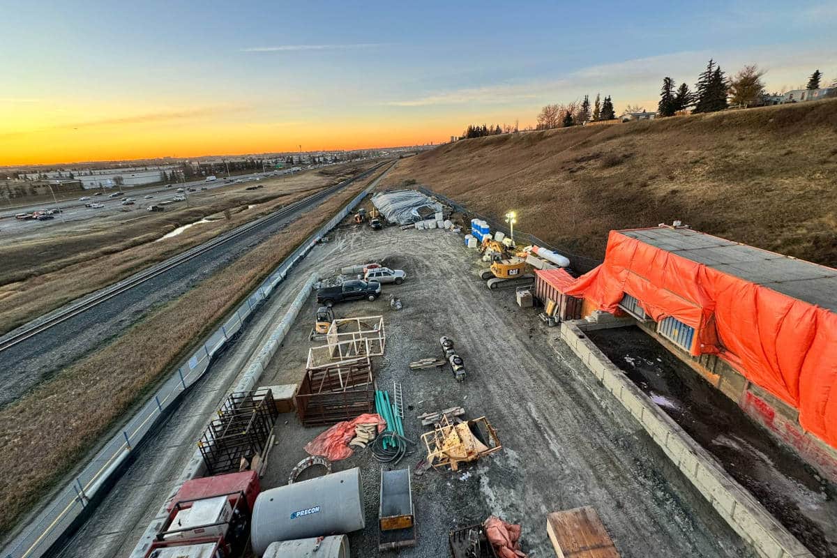
CONSTRUCTION

For both HDD crossing designs, the entry point locations were placed on the west side of the lake in a flat agricultural field. The two HDD alignments were separated by a distance of 20 ft.
Construction began on the northern alignment in early June 2016 and ran through mid-July. Michels completed the pilot hole using the drilled intersect technique, which involves drilling a pilot hole with two rigs from opposite ends of the crossing and ultimately meeting up somewhere in between. Once finished with the pilot hole, Michels enlarged the hole in a single pass using a 24-in. hole opener. On July 16, the HDD and pipeline crews successfully worked together to pull the 16-in. welded steel pipe through the reamed hole, completing the first crossing. Following a two-week break, Michels returned to the site and began the second installation. Roughly a month and a half later, the second 16-in. line was successfully installed beneath the lake.
CONCLUSION
State of the art HDD installations can be completed successfully through the use of proper planning, design, and execution. On Paradigm’s Lake Sakakawea crossings, the project team consisting of Paradigm, J. D. Hair & Associates, Barr Engineering, and Michels worked together from the initial design phase through the successful installation of both pipelines. These installations, with lengths exceeding 11,000 ft, mark a significant achievement in the HDD industry and demonstrate that seemingly impossible crossings are achievable with the right team in place.
David Patonai, P.E., is senior project engineer at J.D. Hair & Associates Inc.