SUE Professionals Unearth Utility Asset Value
Bridging the Gap Between Subsurface Reality and Digital Intelligence
In the complex ecosystem of utility infrastructure, the unseen often holds the greatest significance. Beneath our feet lies a labyrinth of pipes, cables, and conduits – the lifeblood of modern society.
Yet, the precise location and condition of these assets often remain shrouded in outdated maps, incomplete records, and the inherent limitations of traditional locating methods. This lack of accurate, reliable and readily accessible data presents significant challenges for asset owners and excavators. These range from costly project delays and safety hazards to inefficient maintenance and threats to public safety.
This is where firms like Planview Utility Services are pioneering a new era of underground asset management.
Quality Levels of Subsurface Utility Engineering
Using subsurface utility engineering (SUE), these new companies strive at meticulously identifying and accurately mapping subsurface utilities. They go beyond basic designations to integrate this geospatial intelligence directly into their clients’ GIS systems.
By doing so, they deliver geospatial data of all SUE quality levels (QL D-A) for their customer’s entire organization to utilize. Instead of residing in a standalone report, the data becomes integrated.
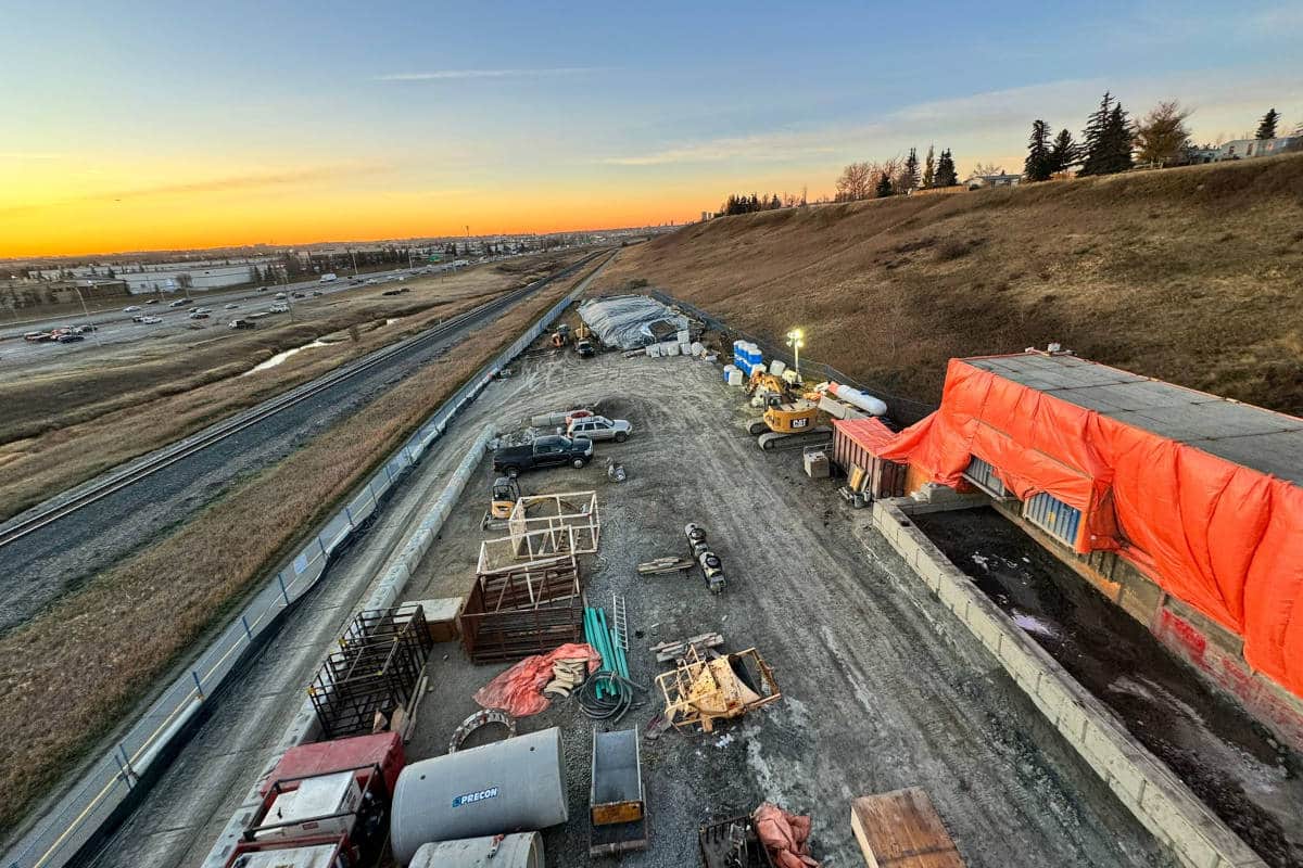
The journey begins with meticulous record research and site reconnaissance (QL-D), gathering all available information. This forms a foundational understanding of the designated project area.
This is followed by surface geophysical methods (QL-C). It includes locating and surveying visible above ground utility end points and capturing invert measurements on catch basins and manholes.
Through the application of electromagnetic induction in (QL-B) to designate the approximate horizontal position, underground facilities are pinpointed. This second last step occurs prior to daylighting the physical location of the buried assets (QL-A).
However, in the evolution of the subsurface utility engineering discipline, it’s the forward-thinking SUE providers that distinguish themselves. They focus on their unwavering pursuit of accuracy. They leverage advanced technologies in conjunction with SUE quality standards to elevate the precision of utility mapping significantly. Instead of simply providing reports on test pits, they strive for more.
Adopting Advanced Technologies
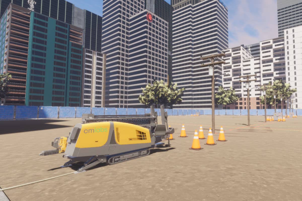
One key offering is ground penetrating radar (GPR), a non-destructive technology that emits electromagnetic waves into the ground. It analyzes the reflected signals to identify subsurface anomalies. These include orphan wells, tree roots, old foundations, archeological deposits, and an array of varying non-utility artifacts. Experienced GPR technicians interpret these complex datasets. They provide a more refined understanding of the location, depth, and material composition of unexpected subsurface obstructions.
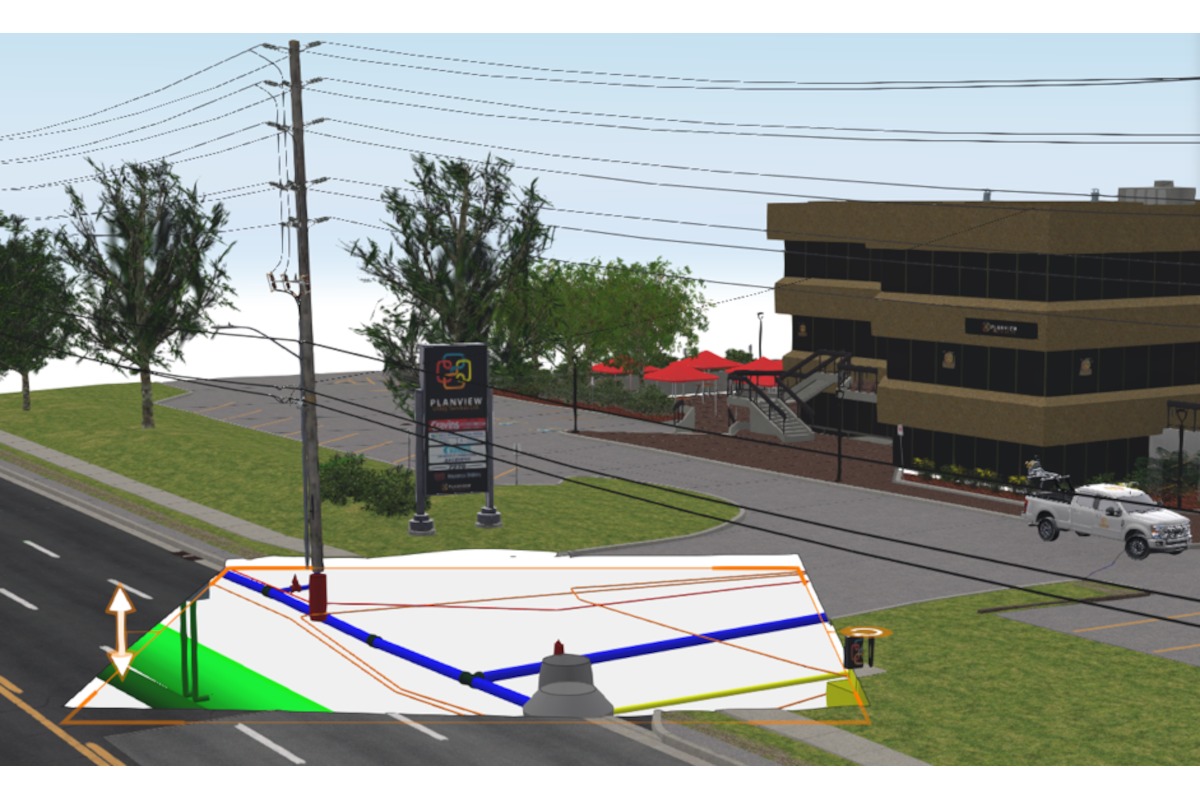
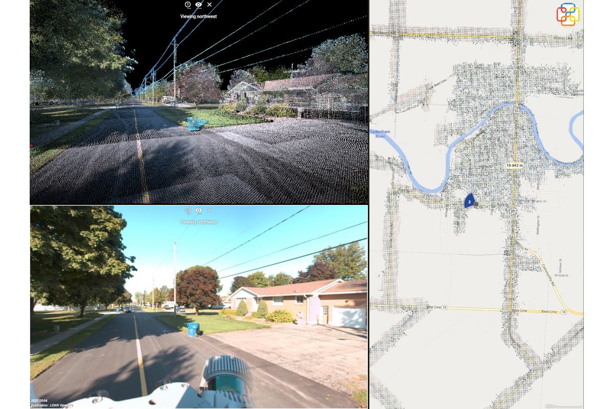
To further enhance and provide a comprehensive 3D understanding of the subsurface environment, the integration of LiDAR (Light Detection and Ranging) technology into a utility’s geospatial application provides the highest degree of accuracy. This is especially true when combined with SUE standards.
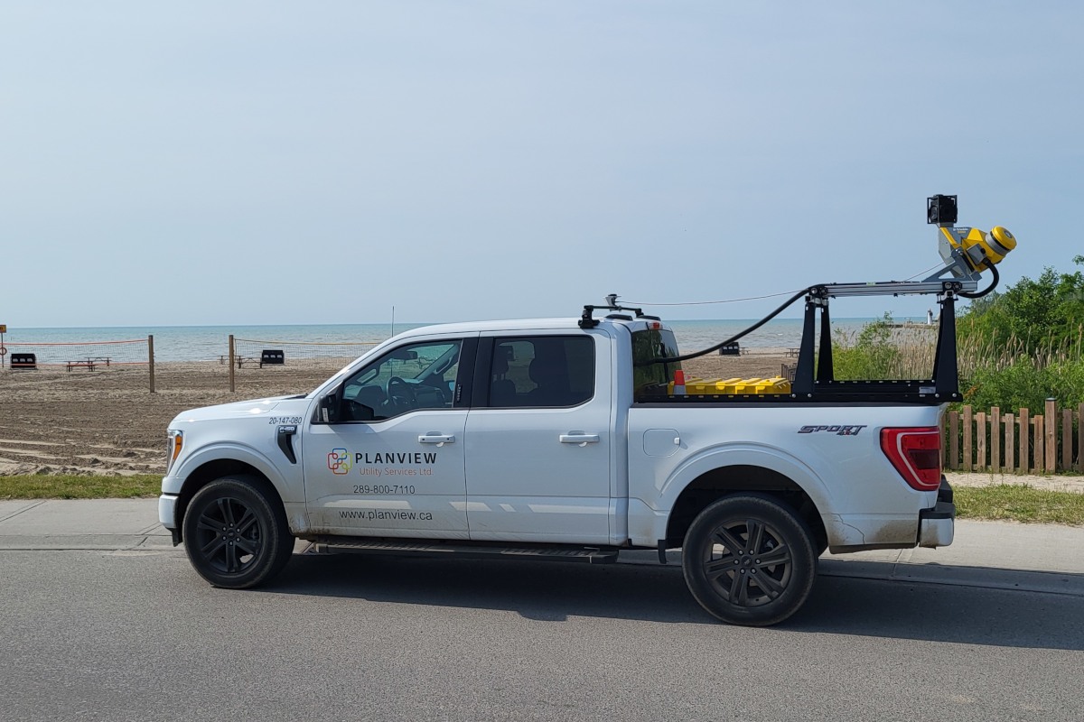
While often associated with above-ground surveying, LiDAR can capture highly detailed topographic data of the surface. This provides a precise spatial context for SUE (QL-B).
This allows for accurate horizontal and vertical referencing of utilities relative to above ground features. This is crucial for integration with existing GIS datasets and for future excavation planning. It is oftentimes crucial for utility asset owners, especially those with both above ground and buried infrastructure.
To attain sub-centimetre accuracy, daylight or expose the underground utilities to achieve SUE (QL-A). This is the highest level of accuracy available. Pairing SUE QL-A with LiDAR technology provides the asset owner with judicial level data integrity that can be leveraged across the entire organization.
Recognizing that knowing the location is only half the battle, closed-circuit television (CCTV) inspection services for buried pipelines and conduits give the utility a front row seat. They provide a visual reference on the condition of their assets.
This invaluable service provides a real-time visual assessment of the internal condition of these assets. It identifies potential defects such as cracks, corrosion, blockages, and leaks. By linking the precise geospatial location of these detected defects, captured through their integrated mapping processes, clients gain actionable insights into the health and integrity of their underground infrastructure.
This proactive approach to condition assessment allows for prioritized maintenance, preventing costly failures and extending the lifespan of critical assets.
Data Integration
The true power of this process lies in a seamless integration of SUE data with a client’s GIS system in conjunction with the aforementioned locational technologies. By working closely with clients to understand their GIS platforms and specific data requirements, it ensures a smooth and efficient data transfer of the SUE investigation findings into a client’s enterprise GIS application. This integration unlocks a wealth of benefits for utility asset owners, including:
Improved Project Planning and Design
Accurate utility locations minimize the risk of conflicts during excavation, reducing delays, costly change orders, and potential damage to existing infrastructure. Engineers and planners can design with confidence, knowing the precise location of buried assets.
Enhanced Safety
Knowing the exact location of underground utilities is paramount for worker and public safety during excavation activities. Precise GIS data significantly reduces the risk of striking buried lines, preventing injuries, environmental damage, and service disruptions.
Efficient Maintenance and Repair
When maintenance or repairs are required, accurate GIS data allows field crews to quickly locate the affected assets. This minimizes downtime and reduces unexpected costs. The integration of CCTV inspection data further streamlines this process by pinpointing the exact location and nature of the problem. This makes it readily available in the customer enterprise GIS application.
Proactive Asset Management
By combining location and condition data within a GIS environment, asset owners can develop proactive maintenance strategies. They can prioritize investments and make informed decisions about asset replacement and upgrades. This shifts the focus from reactive repairs to preventative measures, optimizing asset lifecycle management.
Improved Emergency Response
In the event of a utility strike or other emergency, readily available and accurate GIS data is critical for efficient and effective response. First responders can quickly identify the location of affected utilities, isolate the problem, and minimize the impact to the community.
Enhanced Regulatory Compliance
Many jurisdictions have increasingly stringent regulations regarding the mapping and management of underground utilities through legislation and their respective 1 Call Centres. A high quality SUE firm helps clients meet these requirements and avoid potential penalties.
In a world increasingly reliant on uninterrupted utility services, the precision and insight offered by a SUE firm are not just valuable – they are essential for building a safer, more efficient, and more resilient future. Their commitment to unearthing value beneath the surface is transforming how we understand and interact with the critical infrastructure that underpins our modern lives.