Mag X Geo: Built for Precision, Designed for the Field
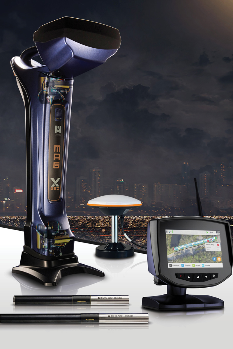
The Mag X Geo builds on our trusted platform and takes jobsite performance to the next level with a powerful combination of precision, durability, and user-friendly design. At the core of the system is a vibrant 7-inch color touchscreen that delivers clear, real-time data in any lighting condition. Whether you’re drilling in full sun or low light, critical locating information is visible at a glance. This eliminates guesswork and keeps your crew moving with confidence.
Control is intuitive, thanks to tactile, multi-function buttons positioned below the display. These raised rubber buttons are designed for real-world use, offering reliable performance even when you’re wearing gloves or working in tough environments. Each button opens a fly-up menu to access key functions without digging through complex screens. This interface keeps everything simple and focused, so crews spend less time navigating and more time drilling.
The system is built around three core functions: Log, View, and Guide.
Log with Confidence
Logging data is a critical part of every bore, and Mag X Geo simplifies the process without sacrificing detail. Operators can log pitch, depth, and GPS coordinates on a rod-by-rod basis, all from a single device. This ensures a complete digital record of the bore path.
As utilities are exposed during drilling, users can mark them in real time. There’s no need to pause or revisit the area later. These utility points are saved with accurate GPS data, improving clarity and accuracy in the final report. With all this information in one place, operators stay in control and reduce the risk of missing or mislabeling important details.

View Your Progress in Real Time
Mag X Geo doesn’t just collect data. It presents it in a way that helps operators stay ahead of the job. Crews can easily switch between Chart, Map, and Rod Table views to monitor progress throughout the bore. Chart view shows a live graph of the bore path. Map view overlays GPS data to provide full spatial context. The rod table breaks down each entry, including pitch, depth, and location.
These views give operators a clear understanding of where they are and what comes next. The result is better decision-making, less rework, and cleaner closeouts.
Guide Every Move with Precision Tools
What sets Mag X Geo apart is its built-in suite of GPS-driven tools that support accurate, efficient drilling.
Dropline replicates a chalk line using high-precision GPS. Set a start and end point, and the system generates a straight-line path. A left-right indicator keeps the drill aligned, helping crews stay on track.
Pitch Guide creates a static rod-by-rod pitch plan to reach your target depth. Once a path is set, it calculates the ideal pitch needed at the end of each rod. If the operator does not hit that pitch exactly, the system does not recalculate the following target. The guide remains fixed unless reset, giving users a consistent reference throughout the bore.
Bore-To allows the crew to place the locator ahead of the drill and work toward it with confidence. It shows projected depth and horizontal distance to the target location, helping ensure alignment with tie-ins, utility crossings, or exit points.
Built for Real-World Demands
Mag X Geo is designed to perform on real jobsites. From its rugged housing and glove-ready interface to its intelligent features and accurate GPS capabilities, everything is made to support productivity in the field.
Whether you’re installing utilities in a tight urban space or handling long rural shots, Mag X Geo gives you the tools to log, view, and guide your bore from start to finish. It streamlines your process, improves the quality of your documentation, and helps your crew deliver more accurate results in less time.
Mag X Geo: Every Detail. Every Rod. Every Time.


