Drill Master: GPR: An Important Tool for Damage Prevention
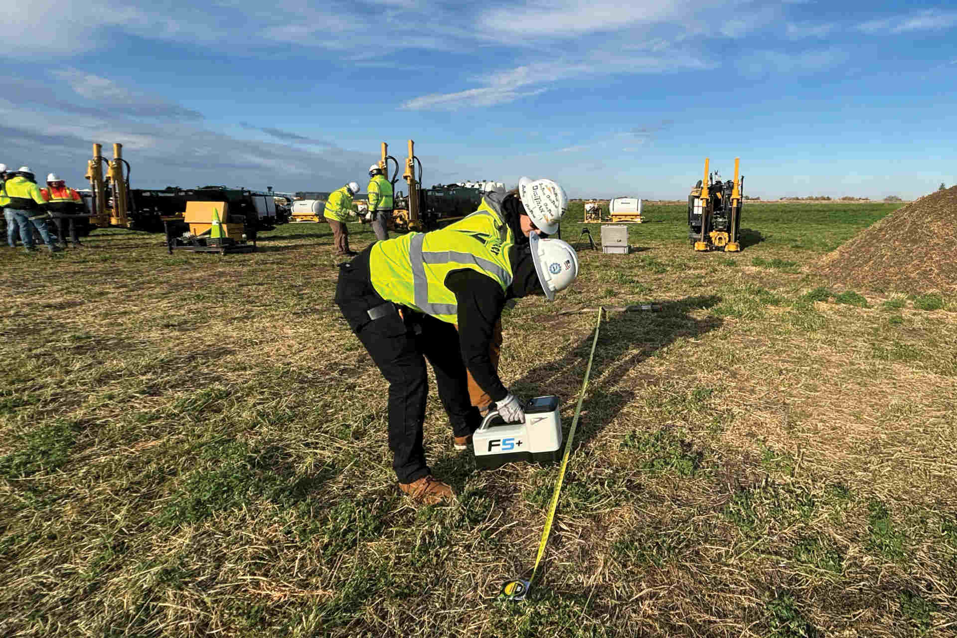
Damage prevention is still not an exact science, but locating strategies, tools and processes are helping to reduce the possibility of damage during utility installations. One of the technologies for identifying and locating utilities is ground-penetrating radar (GPR).
GPR represents damage prevention for municipalities and utility companies. A lot of utility maps are outdated, so when it comes time to dig near infrastructure, GPR can save these companies a great deal of trouble. GPR essentially can pay for itself by preventing one ruptured pipe or gas line.
Unlike standard cable and line locators, which only detect metallic objects, GPR systems locate both metallic and non-metallic obstructions. This is why GPR is becoming a more popular tool among subsurface utility engineering (SUE) firms, which create facility maps or plans for construction crews to follow.
GPR is not without limitations. Some soil has clay content that doesn’t allow a clear reading of underground objects. To identify precisely where buried utilities are, use a vacuum excavation system to expose pipe and cable.
Reducing Risk Step by Step
In addition to employing the right locating equipment for the task, damage prevention also requires thorough jobsite preparation and detailed planning. Recent advancements in software and communications technology have simplified these steps.
Before drilling or excavating begins, it is essential to first study the existing facility maps and then verify the information by calling either the facility owner or the local one-call center. In March, the Federal Communications Commission (FCC) adopted a new national call-before-you-dig number — 811 — in an effort to streamline the process of contacting the local one-call center.
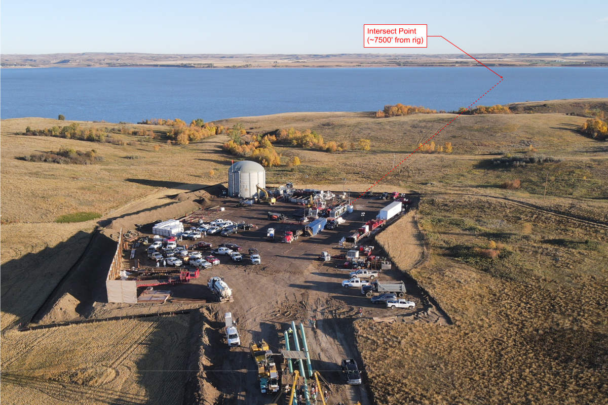
Detailed planning is another vital step in preventing damage to existing utilities and a number of excellent new planning and mapping software packages are making this process easier. Most of these systems allow the user to enter information on topography, aboveground features and both aboveground and underground obstacles, including existing utilities. Planning and mapping systems can be integrated with guidance electronics, enabling the operator to view the bore as it progresses in real-time and recalculate the plan after each locate.
For both excavating and horizontal directional drilling, I strongly recommend adhering to the best-practice techniques that are detailed in the Common Ground Study developed by the Common Ground Alliance (CGA). CGA efforts focus on implementing best-practice procedures identified in the Common Ground Best Practices Study, recognized as the most effective guidelines yet developed for preventing damage to underground facilities, and one of CGA’s primary roles is coordinating information and communications among the various organizations involved in building, maintaining and operating the utility infrastructure. CGA encourages the shared responsibility of utility damage prevention and helps achieve this by refining and disseminating best practice recommendations, developing public awareness through educational programs, supporting appropriate research and serving as an information clearing house. A “Dig Safely” public awareness campaign, including a damage-prevention brochure and video, is in progress to make construction personnel and the general public aware of the importance of notifying one-call centers before construction begins. More information on CGA programs is available on the CGA Web site, at www.commongroundalliance.com.
Thorough jobsite preparation, planning and taking advantage of the latest equipment, software systems and operational techniques will significantly reduce the risk of underground pipe and cable damage.